
Sources for Utah Previous Residents
One Utah address can leave several kinds of history, but no single source answers every question. A recorder index follows property transfers, directories suggest who appeared at a place, maps date structures, and permits document work. Their date ranges overlap unevenly. Start with the best known parcel or street, then use the table to choose a source that fits the question and period instead of assuming every county or city has the same online span.
| Source | Years It Covers | Where Held | What It Shows |
|---|---|---|---|
| County deed and parcel records | Current parcel data; recorder lookback varies by county | County assessor and recorder | Tax parcel, recorded transfers, parties, legal description, and document references |
| FamilySearch Utah County records | 1850–1962 collection; deeds include 1856–1931 | FamilySearch guide and linked record images | Deed parties, dates, property descriptions, and other county series; image and indexing availability varies |
| City directories | Selected 1917–1919 examples and one 1959 suburban volume | Marriott Library digital collection | Name, address, business description, relationship note, and street-index clues |
| Sanborn maps | 1867–1970 where city coverage exists; Salt Lake examples in 1911 and 1926–1927 | Library collections and mapped atlases | Building footprint, use, materials, height, street name, and lot context |
| Salt Lake City permits | Online records generally from 1979; historical search and request routes for gaps | City online permit portal, historical search, and GRAMA | Permit date, address, work description, status, and sometimes owner or builder |
| Utah County historic parcel map | Historic parcel views vary; displayed date is a system-entry date | Utah County Parcel Map | Parcel geometry, deed points, historic configurations, and map context |
Use a deed when the question is who transferred title, a directory when it is who appeared at an address, and a Sanborn sheet when it is how a building or street looked. The coverage table is statewide in scope only where the cited source says so. A Utah County deed collection or Salt Lake permit page does not stand in for the other counties.
Utah Parcels and Previous Residents
Start with the current parcel, not an old name search. The Utah County Parcel Map can be searched by address, serial, owner, or PLSS section, township, and range; its historic view can show earlier parcel configurations and deed points. This is one county’s tool, not a statewide deed index.
The map’s historic parcel date means when the information entered the system, not when a deed was recorded. Keep that distinction beside the parcel number and legal description. The current owner field is a tax or parcel lead, and an owner is not necessarily the person who lived at the address. County GIS layers also use different source and update dates, and none certifies title.
Open the Utah County map viewer to see its address, owner, serial, and historic-parcel controls.
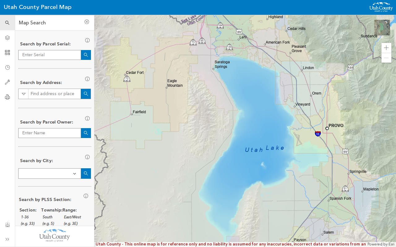
The map can help connect an old legal description to a parcel shape, but it does not certify ownership or replace the recorded instrument.
Tracing Utah Deeds for Previous Residents
A deed chain is built by following recorded instruments backward from a parcel, one transfer at a time. First identify the county, current parcel or serial, situs address, and legal description. The situs address is the place where the property sits; a mailing address can be different. Keep each recorded name and document reference as written, since a street number may change while the land description stays useful.
- Use the assessor or parcel viewer to record the current owner, parcel number, legal description, and source date.
- Find the latest deed or instrument in that county recorder’s index and note its parties, recording date, instrument number, and book or page.
- Take the seller named in that deed and search the earlier index as a grantee, then follow the prior transfer reference.
- Repeat toward older records, checking name variants and keeping a citation for every link in the chain.
- When the web index or images stop, ask the recorder or records center about older books, microfilm, or an Archives series.
These terms name the direction of the search:
- Grantor
- The party giving or transferring an interest in the property.
- Grantee
- The party receiving that interest; a buyer is commonly the grantee in a purchase deed.
- Chain of title
- The linked set of recorded transfers used to follow ownership over time.
- Legal description
- The recorded land description, such as a lot and block or survey reference, that identifies the parcel more precisely than a changing street address.
A chain is only as complete as its records. An index result may identify a deed without displaying the image, and a missing online year does not prove that no deed was recorded.
Utah Recorder Records for Previous Residents
Utah county recorder systems have different online spans, search fields, image access, and older-record handoffs. No single online index establishes a complete deed chain across all Utah counties. Utah County’s land-record menu offers name, address, serial, subdivision, document, book-and-page, and description searches, along with parcel and tax menus. The county warns that staff do not perform title or legal-description research by phone, though a call can help identify the right office, index, or request path.
Salt Lake County provides a different route. Its Public Search can show a current owner, parcel, legal description, and recorded-document list, while Data Services adds paid document and chain-of-title tools. The public search warns that information may be at least a day old; a listed option is $5 for 24-hour image access. Check the live county page for current terms and fees.
If an online search ends too soon, contact the recorder counter or office, ask about written document orders, or send a specific GRAMA request. Utah’s Open Records Portal routes requests to records officers; the State Archives city and county records guide points to older series. Written requests may go through the portal, by email, fax, mail, or in person. Libraries, FamilySearch, and county records centers may hold microfilm or digitized books.
Utah Deeds and Tax Records for Residents
Ownership history is not the same as a list of people who lived in a house. A deed records a transfer or other interest; an assessor’s roll describes a tax parcel and its listed owner; a tax record tracks charges or payment; a mortgage, release, lien, plat, or probate case has its own purpose. Each may name a different party because a lender, heir, trustee, or former owner can appear without being a household resident. Previous residents may never appear in a deed at all.
Utah County’s land-record menu includes serial history, tax history, maps, document images, and name or description searches. Salt Lake County links parcel records to recorded documents and offers a tract index in its paid service. Use those tools to locate the record, then read the instrument and its legal description before drawing a conclusion. If a transfer came through an estate, older probate or court files may be held by the county or the Archives rather than the recorder’s online page.
Utah Street Names and Past Residents
An old name can hide the match between a deed, a directory, and a present-day map. Utah Historical Society notes that Social Hall Avenue in Salt Lake City became Motor Avenue in 1926, then returned to its earlier name by 1950. Search both forms when following a house through those years, and write down the exact street wording on each source before normalizing it.
The Society’s Salt Lake City and Ogden Sanborn map release adds digitized 1926–1927 maps that can help bridge a dated building record. County lines, annexations, lot changes, and city labels can also alter where a search lands. A modern street match is a starting point; a plat or older map can test whether the same piece of land is involved.
Utah Permits for Previous Residents
Salt Lake City permits can add dates and details to a house history, but they are not a roster of everyone who lived there. The city’s online portal supports search by street number, street name, or record number. City information says post-2007 research is available through the portal, while its FAQ identifies public permit and inspection records from 1979 forward. If a known older record is absent, use the historical permit search or a GRAMA request; research, copying, and mailing charges may apply.
The Citizens Access permit-search instructions show the workflow and attachments pictured below.
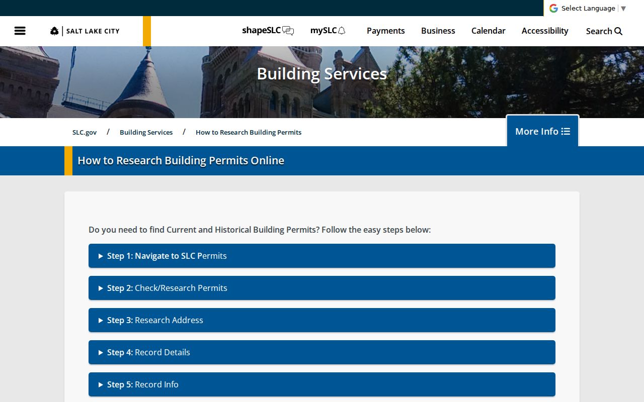
Construction plans are not public through the normal permit interface, and the city says they are maintained for seven years. A permit can identify work, status, and sometimes an owner or builder, but it cannot establish a full ownership chain.
Utah Sanborn Maps for Past Residents
Sanborn sheets show buildings rather than a full list of residents. Available Digital Sanborn coverage for Utah towns and cities spans 1867–1970, with gaps by place. The Library of Congress holds a 1911 Salt Lake City atlas with 119 map images. The Utah Historical Society’s 1926–1927 Salt Lake City and Ogden scans give another local snapshot between older and later map sets.
Compare a map’s street name, lot or building number, footprint, use, material, and height with a directory address or permit date. A map can show that a structure stood on a lot or that a block changed; it cannot prove who occupied it. Pair the sheet with a newspaper, directory, deed, or archive record when the question is who lived there.
Browse Digital Sanborn Maps at the Salt Lake City Public Library and the Library of Congress 1911 Salt Lake City atlas for the map evidence those collections preserve.
Utah Households and Previous Residents
Deeds show transfers; directories and census schedules can place households near those transfers. Utah’s selected directory examples are not a complete criss-cross series, so use the available name and street-index pages as leads. The Utah city directory page explains the collections themselves. For the address trail, pair a directory year with a nearby census schedule and keep the original street and household wording.
- Choose a surviving directory year and record the name, address, page, and image citation.
- Check the nearest census schedule for household relationships and the place as it was enumerated then.
- Compare the street, city, and county names without assuming modern borders applied at the time.
- Use a newspaper, cemetery record, or local collection to test a move, death, or family connection.
- Keep deed evidence separate from evidence that someone lived at the address.
For a current parcel or street-level record trail, the Utah street directory page covers address-keyed sources. Salt Lake City Public Library Archives holds newspaper microfilm, clippings, and local-history collections, with scanners and readers for in-person use. Older records may also surface in cemetery files, probate, or the State Archives. No statewide obituary index was located, so search the local paper and cemetery named by the family or place rather than assuming one index covers Utah.
Lawful personal use. Keep past-resident research focused on family history, house history, and personal curiosity. Do not use records to track, pressure, or harass a living person.