
Utah Street Address Trail
Address research works best as a chain of separate checks. In Utah, start with the county that governs the parcel, because the tax roll, map layers, deed index, and older records may sit in different systems. The situs address is the place tied to a parcel; a mailing address is where a tax notice goes. Neither field alone names every person who uses the street.
Keep the raw address line, including its direction, unit, city, and ZIP, before you normalize it for a search box. Then note the source and date of every result. A Utah street directory search can help connect public records for one road, but the link between an owner and an occupant must never be assumed.
A Utah street directory is an address-based index to separate county, city, and historical sources. Its strongest lead is a parcel number that can be checked against the record held by the right custodian.
- Choose the county on Utah State Parcels, then open that county’s assessor or recorder site.
- Search the assessor by the street address or parcel number and save the parcel ID, legal description, and owner field.
- Open the parcel in the county GIS or statewide map and note which nearby parcels touch the street.
- Follow the recorder’s document index for the parcel or legal description; keep each deed’s parties, date, and instrument number.
- Check public voter or dated directory records only as separate evidence, then contact the local custodian if an older series is missing online.
Utah Street Address Assessor Fields
Salt Lake County’s assessor form is a useful example of a county-level search. It asks for an owner in “Last Name, First Name” order, an address chosen from an autocomplete list, or a parcel number. The number format printed on the official site uses groups separated by hyphens.
The assessor returns tax-parcel details, not a complete street roster. A current parcel result is a starting point for the recorder index or parcel map. Other Utah counties use different forms, and some rural offices rely more on a counter request or a map than a name search.
The Salt Lake County Assessor search shows the actual owner, address, and parcel fields used for a property lookup.
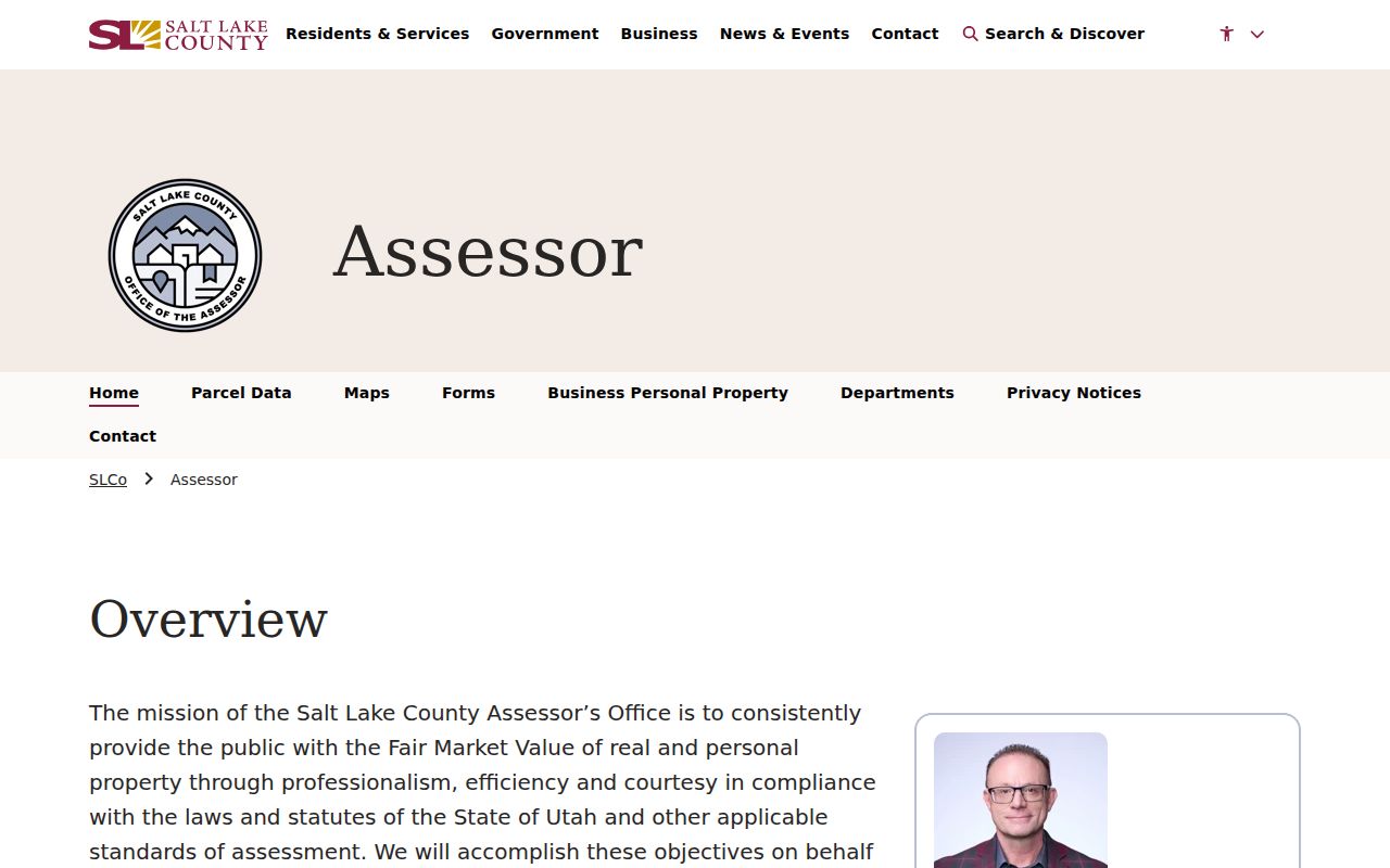
When the address field offers a list, select a matching suggestion rather than assuming any typed string is a valid parcel address.
| Portal and field | Type | Required | Format or use |
|---|---|---|---|
| Salt Lake County: Owner | Text | No | Last name, then first name. |
| Salt Lake County: Address | Autocomplete | No | Begin typing and select a listed result. |
| Salt Lake County: Parcel number | Text | No | Use the parcel-number pattern shown on the form. |
| Utah County: Address search | Linked form | No | Number, direction, street, type, and city; choose current or all records. |
| Utah County: Serial number | Linked form | No | Leading zeros and several formats are accepted by the map viewer. |
| Utah State Parcels: County, street, city, ZIP | Map filters | No | Find or browse, then open the county source. |
Utah County Land Records Search
Utah County Land Records is a menu of linked searches, not a single form. It includes owner and address searches, serial numbers, subdivisions, tax history, delinquent-tax search, payoff, valuation, serial history, parcel maps, document images, and name, abstract, book/page, kind-of-instrument, mining, and water-right searches.
The address form separates number, direction, street, street type, and city or location. “All Records” and “Current Records Only” lead to different result sets. A serial number may be typed with or without punctuation in the map viewer. The recorder cautions that staff do not perform title or legal-description research by phone, so use the portal, visit the counter, or ask a qualified title professional for formal title work.
The menu shown at Utah County’s land-records site is a practical example of how a local address search can branch into tax, map, and recorded-document records.
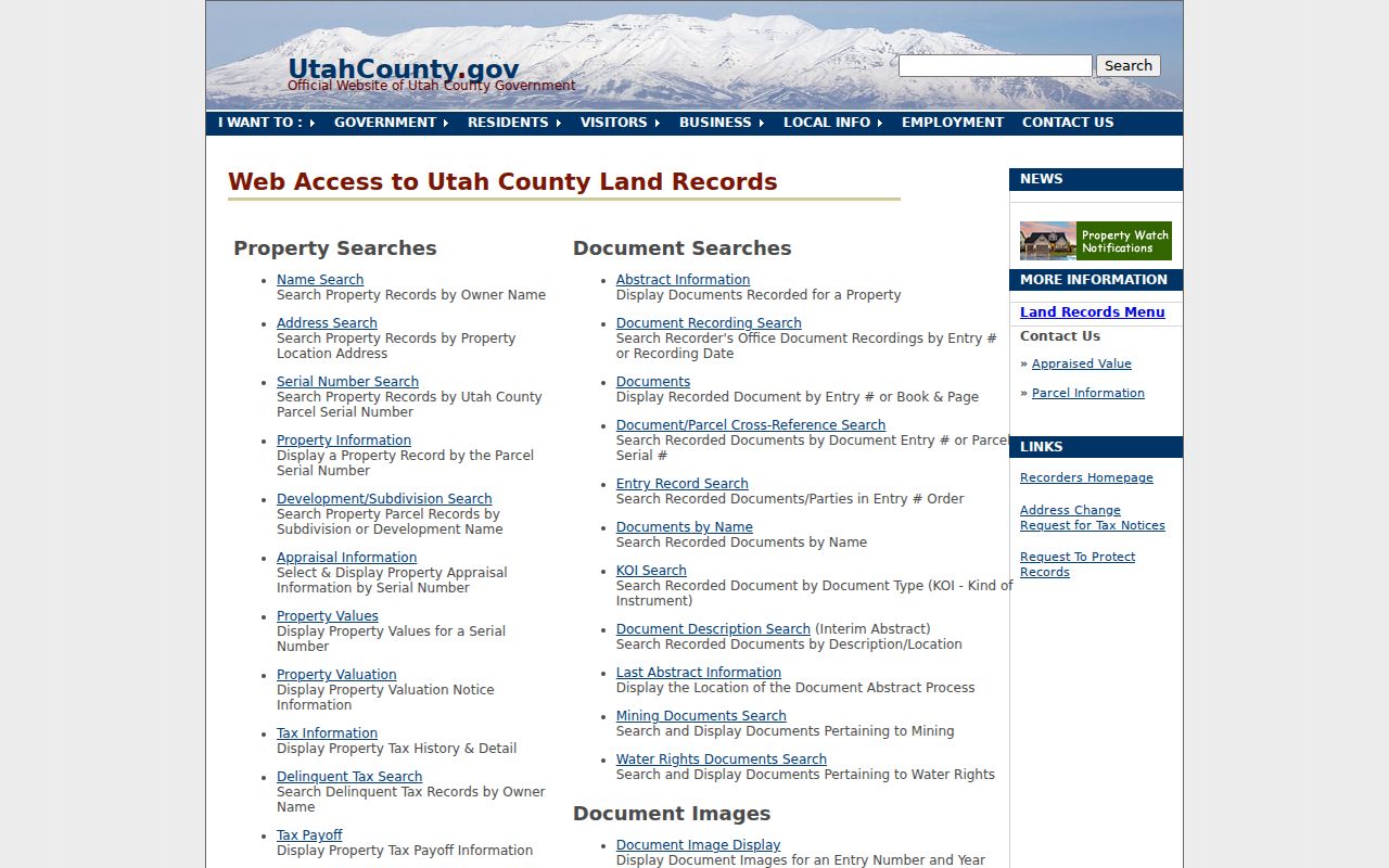
Save the parcel serial before opening a related document or tax-history link, since one address can have more than one record path.
Utah Address Record Layers
Several official records use a street address, yet they describe different things. An assessor entry tracks a tax parcel, a recorder entry documents a legal instrument, a permit traces a building or project, and an election record follows its own public-field rules.
| Address record | Custodian | Street detail | Access route |
|---|---|---|---|
| Assessor parcel | County assessor | Parcel, owner field, tax values, situs and mailing address | County portal or office |
| Parcel geometry | UGRC or county GIS | Parcel ID, location, address points, local layers | Map or data download |
| Deeds, liens, plats | County recorder | Recorded parties, document type, date, legal description | Index, counter, or written request |
| Voter data | State elections or county clerk | Public address, status, precinct, and district fields | Self-lookup or separate request |
| Permits and planning | City or county office | Address, record number, work, inspections, public attachments | Local portal or GRAMA request |
- Parcel
- A mapped tax unit used by the county; one parcel can cover more than one address or building.
- Situs address
- The location address associated with a parcel, distinct from its tax-mailing address.
- Plat
- A recorded map that lays out lots, blocks, streets, easements, and related land divisions.
- Criss-cross directory
- A reverse directory arranged by street address to help identify names associated with a dated address. The reviewed Utah collection sources did not confirm a complete statewide run.
A parcel ID can tie an assessor record to a deed or permit, but a street name can change and the same road may cross city or county lines. For the broader block view, compare the adjacent-parcel and address-point methods with the Utah neighbor lookup.
Utah Street Recorder Result Fields
Salt Lake County’s Public Search can return a parcel and its recorded-document list. The page asks the user to choose an address or parcel from an autocomplete result and warns that data may be 24 hours old or older. Images and deeper title tools route through Data Services, which has paid options.
The screen shows a compact inventory rather than a full household list. Read the document type and recording date before treating a name as connected to a street. A sample record may include these fields:
The Salt Lake County public recorder search displays the parcel and document rows used to follow a recorded address.
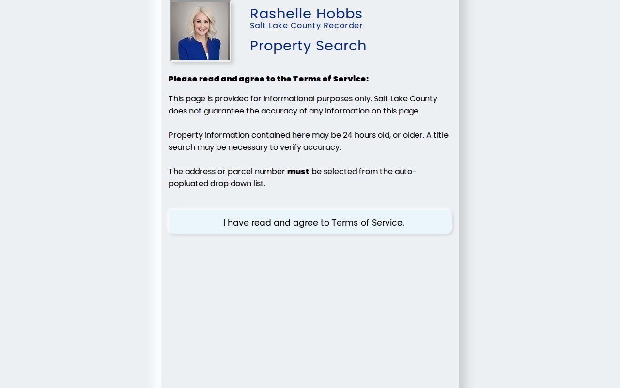
Confirm a result against the county record because a parcel search is a pointer, and a deed image or title review may be needed for the legal chain.
| Result field | What it identifies |
|---|---|
| Property address | The address attached to the displayed parcel. |
| Active parcel number | The county parcel identifier used to open related records. |
| Current owner(s) of record | The indexed name or names associated with the parcel. |
| Recorded documents | Document count and rows with number, recording date, and type. |
| Legal description | Tax-purpose land wording with book and page references. |
| Image access | Copy access through the county service rather than the summary alone. |
Salt Lake’s public page warns that a search result may be out of date, so check the record’s own date before relying on it.
Note: Salt Lake County says its public parcel information may be 24 hours old or older, so verify current details with the custodian.
Utah Parcel and Street Names
Utah State Parcels covers all 29 counties and lets a reader pick a county, search an address or city, enter a ZIP, or browse the map. The UGRC parcel layer adds parcel ID, address, city, and ZIP fields from county sources. Both help locate a parcel; neither map certifies title or proves who uses the property.
County update dates differ, and local viewers may add historic parcels, deed points, measuring tools, or other map layers. Utah County’s parcel map can search by owner, address, serial number, city, or PLSS section, township, and range. Its historic parcel date records when an item was entered in that system, not necessarily when the deed was recorded.
A Utah Street-Name Change
The same Salt Lake City road had two names in different years: Social Hall Avenue became Motor Avenue in 1926, then returned to Social Hall Avenue by 1950. The Utah Historical Society’s map release notes document the interval, a reminder to search the name printed on each dated source.
Plats and historical maps can also show a street vacation, widening, dedication, or changed lot line. Keep an original address string beside any modern match. The county, city, and parcel may not have used the same label at the time an older directory was made.
Salt Lake Permits by Address
Salt Lake City’s building-permit guide accepts a street number and street name, or a permit or record number. The city recommends trying a short number and street name before adding direction or suffix details. A result’s Record Info opens details, and public attachments may appear as download links.
The how-to page points post-2007 searches to Citizens Access and older searches to the city’s historical permit tool. The FAQ describes public permit and inspection records from 1979 forward, so use both routes when an address falls near the cutoff. If the file is missing, the city directs requests to GRAMA. Plans are not available through the usual permit screen, and the FAQ says they are kept for seven years. For a new or changed city address, Salt Lake also has a certified-address request.
Utah Voter Address Fields
A public voter record can carry a residential or mailing address, age range or year of birth, district, party or status, update date, and vote history. Vote.Utah.gov itself is for a voter to check their own status and polling place. A public list request is a separate process, handled through the state voter-data route or county clerk under Utah law.
Full birth date, driver or state ID, Social Security number, phone, email, signature, and at-risk data are withheld under the state’s voter privacy rules. The Safe at Home program also shields enrolled participants’ actual location. Treat a protected or missing address as a boundary. Do not try to fill it in from a parcel map or an old directory.
Utah ZIP and Quadrant Details
Utah address points include a source and date, and can carry unit, landmark, city, ZIP, FIPS, or USNG fields. The state layer draws from local addressing authorities, so a Salt Lake, Weber, or rural county point may have a different update cadence. Preserve a direction and unit instead of removing them to make an address fit a generic search.
Street grids have local origins. The UGRC quadrant guide notes that St. George uses Tabernacle and Main as its origin; Santa Clara counts from St. George; Hildale’s grid relates to Colorado City, Arizona. A ZIP is a postal label, not a city boundary. When an address crosses systems, retain the original wording and check the local city or county address authority.
Note: Utah ZIP polygons are approximate delivery areas and do not establish a parcel, city limit, or resident’s current address.
Missing Utah Address Records
If a county index stops at a recent year or lacks an image, move to the custodian’s next access channel. The county recorder or assessor counter can help identify a series; phone staff can direct a request to the right office; an email, mailed letter, or GRAMA form can ask for a record by address, parcel, person, and date range. Use the current Utah Open Records Portal to find a state records officer.
When a Utah street directory search reaches a web gap, record which county, address spelling, parcel, and date range you checked before moving to the paper or archive route.
Historical records may be held by the State Archives, FamilySearch, a local library, or a county historical collection. Ask by record series and date rather than treating an online search failure as proof that nothing exists. For older addresses, the relevant city directory or newspaper may be the next independent check; its complete collection notes are on the Utah city directory page.
Limits of a Utah Street Directory
A street search may find the owner on a tax roll, a name on a deed, or a public contact on a permit. It does not produce a complete list of people in nearby homes. A parcel can contain several units or represent an entity, while one building may have many address points.
Utah’s motor-vehicle records are protected by federal and state privacy rules and are not an informal address source. Utility customer files are not a public street roll either. Court and voter addresses can be old, filed for a specific purpose, or shielded under a protection program. Use the source that created the record and stop when the public field ends.
Lawful use. Utah public records support personal, lawful research and civic access. Do not use a street or parcel search to stalk, harass, threaten, or harm anyone.